
Cart 2 india
In2Cart
Rs. 0
0


Product Information
Specification
Brand : YellowMaps
BulletPoint1 : Printed on Polypropylene (plastic)
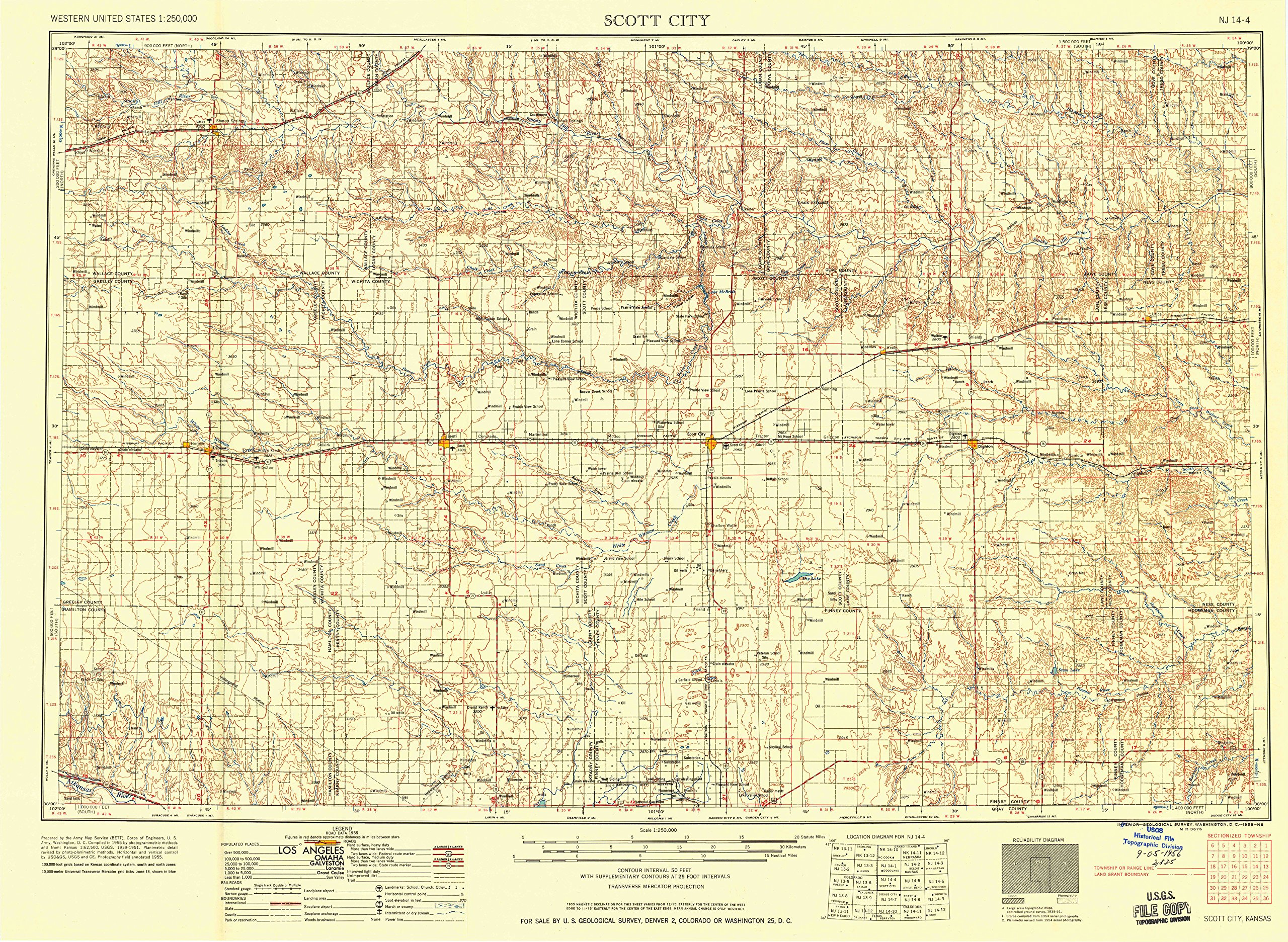
BulletPoint2 : USGS topographic map of Scott City, KS, at 1:250000 scale. Heavier material. Waterproof. Tear-resistant. Foldable. Perfect for the outdoors.
BulletPoint3 : Cities, towns, villages: Kalvesta,Russell Springs,Scott City,Horace,Whitelaw,Shallow Water,Sunland,Shields,Leoti,Grigston,Rodkey,Healy,Modoc,Selkirk,Medway,Unified Government of Greeley County (balance),Weskan,Amy,Gove,Gano,Manning,Marienthal,Lowe,Walkinghood,Lydia,Tribune,Sharon Springs,Peterson,Chevron,Beeler,Ravanna,Friend,Hutchins,Alanthus,Coronado,Pence,Arnold,Laird,Wolf,Elkader,Utica,Alamota,Astor,Wallace,Tennis
BulletPoint4 : Islands: Consult topo map preview for visible islands.
BulletPoint5 : Parks and forests: Hamilton County State Park,Logan County State Park,Steele Monument,Lane Wildlife Area,Hamilton State Fishing Lake and Wildlife Area,Scott State Game Management Area,El Cuartelejo Ruins,Finney State Fishing Lake and Wildlife Area,Logan State Fishing Lake and Wildlife Area,Lakeview Park,Squaws Den Monument,Lake Scott State Park,Monument Rocks National Natural Landmark
Color : Polypropylene
ItemName : YellowMaps Scott City KS topo map, 1:250000 Scale, 1 X 2 Degree, Historical, 1958, Updated 1958, 21.8 x 29.79 in - Polypropylene
ItemTypeKeyword : outdoor-recreation-topographic-maps
Manufacturer : USGS
PartNumber : USGS-5973574-POLY
ProductDescription : Printed on Polypropylene
ProductSiteLaunchDate : 2018-12-03T12:42:40.066Z
UnspscCode : 55101500