
Cart 2 india
In2Cart
Rs. 0
0


Product Information
Specification
Binding : map
Brand : Waterproof Charts
BulletPoint : Great Product
BulletPoint1 : Bracket
BulletPoint2 : Package Weight: 4.0 pounds
BulletPoint3 : Included components: Mounting Bracket
BulletPoint4 : Package Dimensions: 15.0 L x 7.0 H x 10.0 W (inches)
Color : Red
ExternallyAssignedProductIdentifier1 : 0740399311133
ExternallyAssignedProductIdentifier2 : 740399311133
FinishType : Black
Format : lay_flat
GpsrSafetyAttestation : 1
ImportDesignation : Made in the USA
IncludedComponents : Great Product
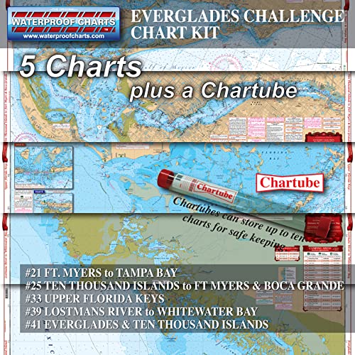
ItemName : Everglades Challenge Chart Kit, 5 Standard Navigation Charts, Florida Boating, Easy-to-Read, Large Print, Waterproof Paper, Tear Resistant, Printed on two sides, 2 charts in 1, NOAA Charts
ItemPackageDimensions_Height : 4 inches
ItemPackageDimensions_Length : 10 inches
ItemPackageDimensions_Width : 8 inches
ItemPackageQuantity : 1
ItemTypeKeyword : boating-gps-accessories
Language : english
Manufacturer : Waterproof Charts
MapScale : 1:51500
MapType : Travel
Material : Plastic
ModelName : DT820PV-235-N2
ModelNumber : DT820PV-235-N2
MountingType : Flange Mount
NumberOfItems : 1
PackageLevel : unit
PaperFinish : watercolor
PaperSize : Large
PartNumber : CK13
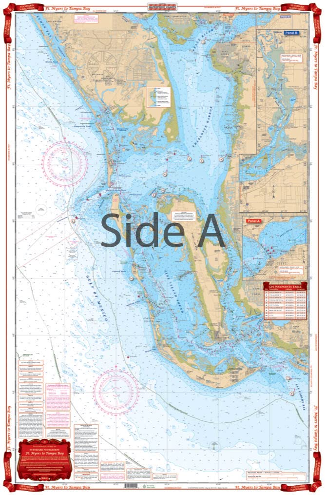
ProductDescription : 5 Waterproof Charts and a Chart Tube make the planning and execution of your trip from Tampa Bay to the Florida Bay possible. Charts include: #21 Ft. Myers to Tampa Bay; #25 Ten Thousands Islands to Boca Grande; #41 Everglades and 10000 Islands; #39 Lostmans River to Whitewater Bay; #33 Upper Florida Keys; This chart kit that includes 5 charts plus a chart tube takes along the west coast of Florida from Tampa Bay down to the Upper Florida Keys. - Easy-to-Read - Large Print Waterproof Paper - Tear resistant Paper (Indescribable) - Printed on two sides - 2 charts in 1 - Larger Area of Coverage Charts are Compiled From Several NOAA Charts & Local Information
ProductSiteLaunchDate : 2021-10-11T19:56:26.364Z
PublicationDate : 2010T
Size : One Size
Style : Compact
SupplierDeclaredDgHzRegulation : not_applicable
UnitCount : 1
UnspscCode : 55101500
WarrantyDescription : Warranty