
Cart 2 india
In2Cart
Rs. 0
0


Product Information
Specification
Binding : map
Brand : Fish-n-Map Company
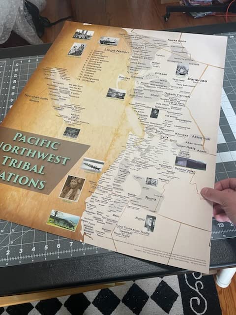
BulletPoint : Most comprehensive Tribal maps in existence
BulletPoint1 : Track Your Scotland Golfing Adventures at 50 of the Top Courses in Scotland
BulletPoint2 : Rustic Black 2 inch wide frame overall 27.5 Inches High x 19.5 Inches Wide
BulletPoint3 : Great conversation starter and Unique Gift Idea
BulletPoint4 : Includes 150 pins in a mixture of Red, White and Black
BulletPoint5 : Ready to hang on your wall
Color : White
Department : ""
ExternallyAssignedProductIdentifier : 00197644779284
ExternallyAssignedProductIdentifier1 : 0761428012418
ExternallyAssignedProductIdentifier2 : 761428012418
Format : folded_map
Format1 : folded_map
Format2 : folded_map
Format3 : folded_map
Format4 : folded_map
Format5 : folded_map
GpsrSafetyAttestation : 1
IncludedComponents : Components included in the description
ItemDisplayDimensions_Length : 27.5 inches
ItemName : Standley, Taylor, Williams Fork, Wolford Fishing Map
ItemPackageDimensions_Height : 26 inches
ItemPackageDimensions_Length : 26 inches
ItemPackageDimensions_Width : 3 inches
ItemPackageQuantity : 1
ItemShape : Rectangular
ItemTypeKeyword : fishing-charts-and-maps
Language : english
Language1 : english
Language2 : english
Language3 : english
Language4 : english
Language5 : english
Manufacturer : Fish-n-Map Company
MapScale : 1:24,000
MapType : Topographic
MapType1 : Freshwater
MapType2 : Freshwater
MapType3 : Freshwater
MapType4 : Freshwater
MapType5 : Freshwater
Material : Glossy matte poster
ModelName : Nuevo 2024 - Naeu004r - Mar Irlandés Eu004r - Regular
ModelNumber : NN-812
NumberOfBoxes : 1
NumberOfItems : 1
PackageLevel : unit
PaperFinish : glossy
PaperSize : 12x38 inches
PartNumber : STWF
Pattern : Plain-Coloured
ProductDescription : Fish-N-Map Company underwater topography maps are printed on a waterproof, tear-resistant material and are folded to 9" x 4". When opened, each map is approximately 3' x 2' in size and is printed on both sides. These maps feature waterproof plastic "paper"; underwater depth contours; fish locations; latitude and longitude for GPS; often multiple lakes on one map; boat ramps; recreational facilities; and much more.
ProductSiteLaunchDate : 2020-08-05T22:19:45.907Z
PublicationDate : 2018T
Size : 28x22 inches
Style : Traditional
SupplierDeclaredDgHzRegulation : not_applicable
SupplierDeclaredDgHzRegulation1 : not_applicable
SupplierDeclaredDgHzRegulation2 : not_applicable
SupplierDeclaredDgHzRegulation3 : not_applicable
SupplierDeclaredDgHzRegulation4 : not_applicable
SupplierDeclaredDgHzRegulation5 : not_applicable
UnspscCode : 55101500
WarrantyDescription : 2 year manufacturer