
Cart 2 india
In2Cart
Rs. 0
0


Product Information
Specification
AgeRangeDescription : Adult
Binding : apparel
Brand : Paradise Cay Publications, Inc.
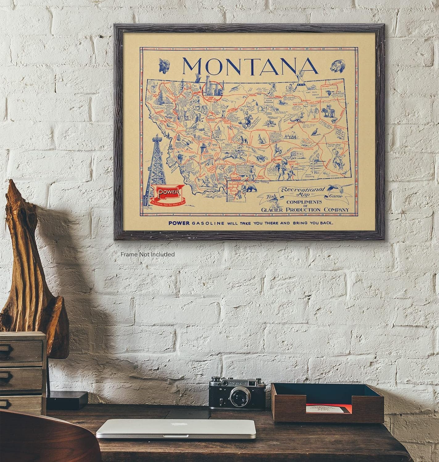
BulletPoint1 : Montana showing various Indian reservations, towns, hunting areas, fishing holes, cities, and national parks
BulletPoint2 : Made in USA | Giclee reprint made in the USA
BulletPoint3 : Quality Materials | Pigment inks on PolyPro paper or Artist Canvas
BulletPoint4 : Expertly Sized | Fits into economical standard frames
BulletPoint5 : Packaged with Care | Shipped promptly in a heavy gauge tube
Color : Black
ExternallyAssignedProductIdentifier1 : 0745808178680
ExternallyAssignedProductIdentifier2 : 745808178680
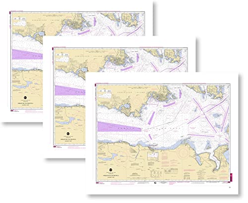
ItemName : Paradise Cay Publications, Inc. NOAA Training Chart 18465 Straight of Juan De Fuca Eastern Part 3-Pack
ItemPackageDimensions_Height : 2 inches
ItemPackageDimensions_Length : 19 inches
ItemPackageDimensions_Width : 2 inches
ItemPackageQuantity : 1
ItemShape : Rectangular
ItemTypeKeyword : fishing-charts-and-maps
Manufacturer : Paradise Cay Publications, Inc.
MapType : Historical
Material : Paper
MountingType : Wall Mount
NumberOfItems : 3
Orientation : Landscape
PaintType : Watercolor
PaperFinish : matte
PartNumber : PR_1839_24L
Pattern : Solid
ProductDescription : NOAA training charts are nautical charts produced by the National Oceanic and Atmospheric Administration (NOAA) that are specifically designed for training purposes. These charts are used by professional mariners, sailors, and students to learn and practice marine navigation skills. NOAA training charts cover a variety of areas, including coastal and offshore waters, and are available in both paper and electronic formats. They include detailed information such as water depths, obstructions, aids to navigation, and other navigational information required for safe marine navigation. These charts are an essential tool for those seeking to improve their marine navigation skills and can be used for a variety of purposes, such as classroom instruction, simulator training, and self-study.
ProductSiteLaunchDate : 2022-02-13T19:11:28.815Z
Size : 16L" x 12W"
Style : Coastal
SubjectKeyword : 'reference', 'non-fiction'
SupplierDeclaredDgHzRegulation : not_applicable
SupplierDeclaredHasProductIdentifierExemption : 1
TargetGender : unisex
Theme : Nautical
UnspscCode : 60121013
WallArtForm : art_print
WebsiteShippingWeight : 11.24 pounds