
Cart 2 india
In2Cart
Rs. 0
0


Product Information
Specification
Binding : map
Brand : Captain Segull's Sportfishing Chart
BulletPoint : Laminated Fishing Chart
BulletPoint1 : OceanGrafix provides mariners with the most up-to-date, NOAA-approved nautical charts ever offered
BulletPoint2 : Charts are printed only after an order has been received, ensuring the most up-to-date information
BulletPoint3 : All Notice to Mariners corrections are applied
BulletPoint4 : Meets U. S. and international carriage requirements for commercial vessels
BulletPoint5 : U. S. Coast Guard approved
Color : waterproof laminated
ExternallyAssignedProductIdentifier1 : 0653210107047
ExternallyAssignedProductIdentifier2 : 653210107047
Format : folded_map
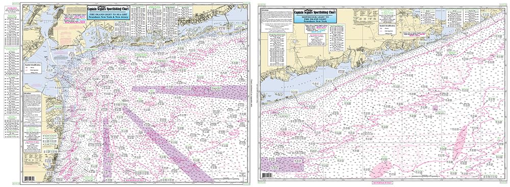
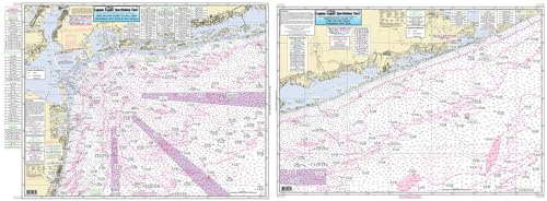
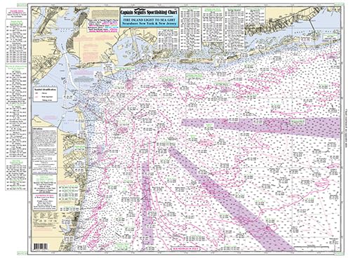
ItemName : Off Coastal New York - Laminated Nautical Navigation & Fishing Chart by Captain Segull's Nautical Sportfishing Charts | Chart # ONY59
ItemPackageDimensions_Height : 4 inches
ItemPackageDimensions_Length : 36 inches
ItemPackageDimensions_Width : 4 inches
ItemPackageQuantity : 1
ItemShape : Rectangle
ItemTypeKeyword : fishing-charts-and-maps
Language : english
Manufacturer : Captain Segull's Nautical Charts, Inc
MapScale : 1:24,000
MapType : Navigational
Material : Polypropylene
ModelNumber : MT-18645
PaperFinish : premium_glossy
PaperFinish1 : matte
PaperFinish2 : smooth
PaperSize : 35 x 46 inches
PartNumber : ONY59
ProductDescription : Nearshore Fishing Chart: Off-Coastal Laminated Fishing Charts highlighting the wreck and reefs off New York. From Shinnecock, NY to Seagrit, NJ sDouble sided laminated fishing Chart. Shows fishing areas, wrecks, reefs, local names and amenities in GPS out to the thousandths of a minute. 19.5" x 26.5" Uses NOAA Charts 12326 & 12353
ProductSiteLaunchDate : 2016-02-27T21:48:51.800Z
PublicationDate : 2017-10-09T00:00:00.000-07:00
ShipsGlobally : 1
Size : 19.5" x 26.5"
SubjectKeyword : 'non-fiction', 'sport'
SupplierDeclaredDgHzRegulation : not_applicable
UnspscCode : 60101700