
Cart 2 india
In2Cart
Rs. 0
0


Product Information
Specification
Brand : Captain Segull's Sportfishing Chart
BulletPoint : Laminated Fishing Chart
BulletPoint1 : The Kankakee River within Illinois is listed on the Federal Clean Streams Register and is well-known by northeastern Illinoisans for its rugged beauty. These waters are top-rated for smallmouth bass, with excellent opportunities for boat, shore and wading anglers. This map covers 57 river miles.
BulletPoint2 : Made of durable, waterproof material
BulletPoint3 : Shaded depth areas
BulletPoint4 : Expertly researched, color coded, marked fishing areas included and boat accesses clearly marked
Color : waterproof laminated
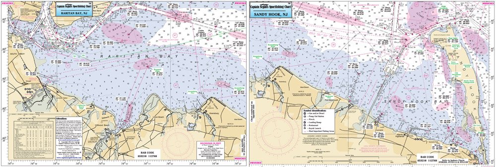
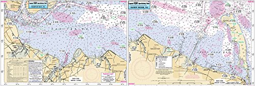
ExternallyAssignedProductIdentifier1 : 0653210112768
ExternallyAssignedProductIdentifier2 : 653210112768
ItemName : Captain Segull InshoreRaritan Bay to Sandy Hook, NJ Fishing Nautical Chart # RSH363
ItemPackageQuantity : 1
ItemTypeKeyword : fishing-charts-and-maps
Manufacturer : Captain Segull's Nautical Charts, Inc
NumberOfItems : 1
NumberOfPieces : 1
PartNumber : RSH363
ProductDescription : Small Boat/Kayak Inshore Fishing Chart detail of Raritan Bay to Sandy Hook, NJ Double sided laminated fishing Chart. Shows fishing areas, wrecks, reefs, local names and amenities in GPS out to the thousandths of a minute. 12" x 18"
ProductSiteLaunchDate : 2018-11-20T08:00:00.000Z
Size : 12" x 18"
Style : Modern
UnitCount : 1
UnspscCode : 49131500